Regional Profile
-
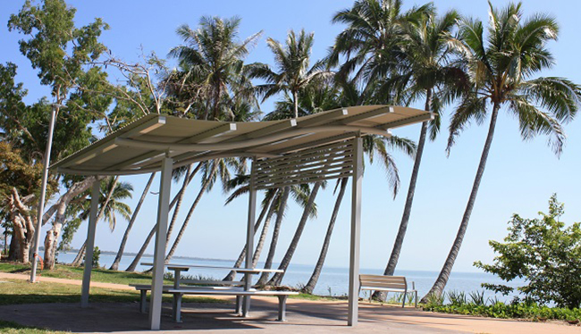
Innisfail, the largest town in the Cassowary Coast, has a population of around 10,000 and is located at the junction of the North and South Johnstone Rivers, just 5km from the coast. Situated 90km from Cairns along the Bruce Highway, it's easily accessible by car, bus, or train.
With a warm tropical climate and lush greenery year-round, Innisfail enjoys temperatures ranging from 26 to 30°C. Agriculture, particularly bananas, sugar cane, and tropical fruits, drives the local economy, with Mourilyan Harbour serving as a key regional port.
Tourism is on the rise, attracting backpackers, particularly those working in agriculture. Innisfail is also a service hub with shopping, government services, and regional healthcare and education.
The town is surrounded by stunning natural attractions, including two World Heritage Areas: the Great Barrier Reef and Wet Tropics rainforests. Nearby beaches like Etty Bay and Kurrimine Beach, as well as Wooroonooran National Park, offer plenty of outdoor adventures. Visitors can also explore a historic Spanish-style castle, tropical fruit winery, and sugar industry museum.
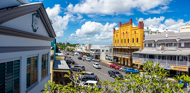
Innisfail is famous for its impressive collection of art deco buildings. Take a self-guided tour with a brochure from the Innisfail Visitors Information Centre and discover the town's unique charm.
-
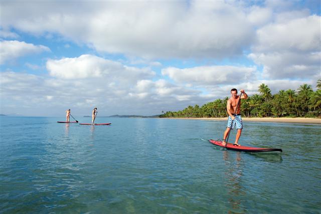
Mission Beach is a stunning tropical destination, known for its world-heritage rainforests, pristine beaches, and island getaways. Located 165km south of Cairns, it’s made up of four villages—Bingil Bay, Mission Beach, Wongaling Beach, and South Mission Beach—linked by 14km of palm-fringed coastline.
With a warm tropical climate, Mission Beach offers year-round appeal, from the cooler dry season (May to October) to the warmer wet season (November to April). Accommodation options range from luxury resorts to budget-friendly motels and bed & breakfasts, catering to families, adventurers, and backpackers alike.
Mission Beach is a hub for adventure with activities like Great Barrier Reef trips, fishing, kayaking, tandem skydiving, and white-water rafting. The region also offers excellent shopping and dining, with cafes featuring local produce.
Dunk Island is just a 10-minute boat ride away, and the area is home to the endangered southern cassowary, often spotted in the surrounding rainforest. Weekly tropical fruit tastings at the Visitor Information Centre are a must-do for food lovers.
-
Tully, located 148km south of Cairns, is renowned for its lush surroundings of bananas, sugar cane, and world-heritage rainforest. With a population of around 3,000, it's famous for scenic Mt Tyson and the Golden Gumboot, a 7.9m statue celebrating the record 7,900mm of rain the town received in one year.
As Australia’s banana heartland, agriculture is at the core of Tully’s economy, with the Tully Sugar Mill processing about two million tonnes of cane annually. The town offers a range of services, including shops, supermarkets, and medical facilities, and is a popular base for working backpackers.
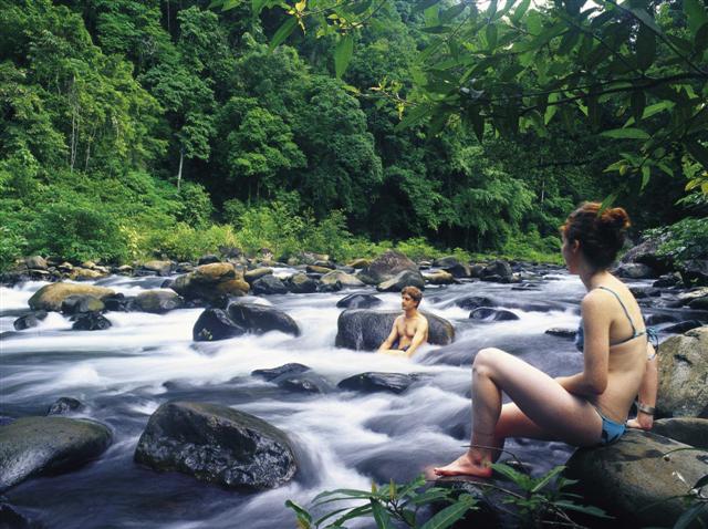
Outdoor enthusiasts will love Tully’s natural attractions, including the 640m-high Mt Tyson, which offers spectacular views, and the Tully River, one of the best white-water rafting spots in Australia. Nearby Tully Gorge National Park and Alligators Nest picnic area provide even more adventure and relaxation options.
Tully is also close to Mission Beach, Tully Heads, and Hull Heads, which offer stunning coastal views, fishing, and boating opportunities.
-
Cardwell, located 165km north of Townsville, is the southern gateway to the Cassowary Coast and the entry point to Hinchinbrook Island, home to the world-renowned Thorsborne Walking Trail. Known for its tropical climate, it’s a favorite spot for fishing enthusiasts and outdoor lovers.
The town offers a range of services, including accommodation options, cafes, and restaurants serving fresh, locally-sourced prawns. Visitors can enjoy a round of golf at the Cardwell Country Club or explore the surrounding natural beauty, including national parks, waterfalls, and scenic walks like the Cardwell Forest Drive.
Hinchinbrook Island, just 5km offshore, is a wilderness paradise with 393sqkm of rainforest and beaches, accessible by ferry from Cardwell or Lucinda. The town also boasts a revamped esplanade, local art galleries, and the Cardwell Bush Telegraph Centre, offering a glimpse into the region's history.