- This is important to understand as this will also influence what type of PAC to install and the extents of the PAC.
- Please use CCRC mapping Service
- Below is an example of what to look for. *Note that should the road adjacent to the property in question be RED in the linked road network map – this is State controlled road (identified in Step 1)
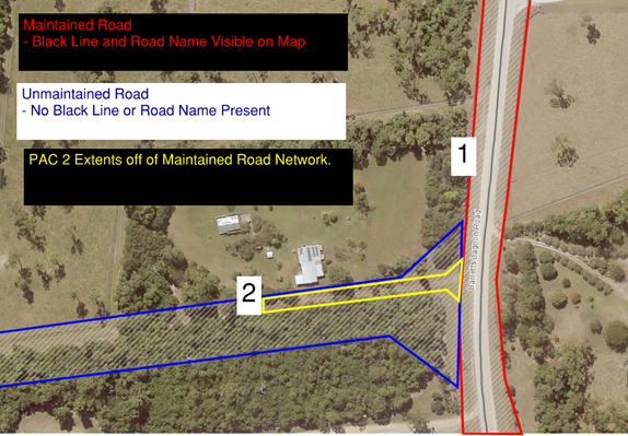
Using the example above if the owner of the property wanted to install a PAC at location 1 from the Red Section (Barretts Lagoon Road) their PAC would start from the maintained road and end at the property boundary.
If the property owner wanted to install a PAC at location 2 their PAC would also start from the Red Maintained Road Section and will lead all the way to their property boundary at location 2 (show example on map in Yellow).
As the blue area is not part of the Council’s maintained road network all maintenance in this area is the responsibility of the property owner including the maintenance of trees.
Please find more information on our Roads here with Council's Road Network Policy(PDF, 505KB).