Cassowary Coast flood monitoring project recognised for excellence in
Published on 27 October 2026
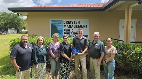
Cassowary Coast Regional Council has been recognised for its innovative approach to flood monitoring, taking home the Local Government Mutual Services (LGMS) Risk Excellence Award at the Local Government Association of Queensland (LGAQ) Conference on Tuesday evening last week.
The award recognises Council's Flash Flood Sensor Network project, which uses radar technology to monitor water levels at known flood-prone locations across the region.
The information from the flood sensors is integrated into the Cassowary Coast Disaster Dashboard, giving residents, emergency services and Council access to local conditions as they change.
Cassowary Coast Mayor Teresa Millwood said the recognition highlighted Council's commitment to finding practical ways to improve community safety and disaster preparedness.
"Living on the Cassowary Coast, we know how quickly heavy rainfall can turn into dangerous flooding, particularly in areas where water levels can rise with very little warning," Mayor Millwood said
"These sensors give us another set of eyes on some of our known flood trouble spots, providing real time information without having to send staff out into potentially dangerous conditions.
"What's important is that this information isn't just for Council. Our residents in flood prone areas can also access this information on the Disaster Dashboard to help them asses their risk, get prepared and make plans in case flooding looks likely."
The network has already supported information sharing with local police and State Emergency Service personnel around Mission Beach, helping emergency services monitor conditions at known flood-prone locations.
Previously, monitoring these locations relied heavily on weather forecasts, community reports and staff inspecting conditions on the ground.
The technology provides another source of information to support earlier identification of rising water levels, planning for potential road closures and coordinating responses during heavy rainfall.
Council is continuing to assess the network through a three-year trial, using observations from residents and emergency services to verify sensor readings and evaluate its effectiveness.
Mayor Millwood said the project was another example of Council investing in practical solutions to strengthen the region's resilience.
"While we can't prevent heavy rainfall or flooding, we can improve the information available to help our community prepare and respond," she said.
"As we start preparing for another wet season, I encourage everyone to explore the Disaster Dashboard, understand the risks in their area and have a plan in place before severe weather arrives."
Residents can access flood monitoring information, road updates and other important disaster information on the Cassowary Coast Disaster Dashboard.
Visit: www.disaster.cassowarycoast.qld.gov.au and tick **NEW** Water Levels and click on a blue icon to view water level information.
Remember: Floodwater can be dangerous, even when it looks shallow. If it's flooded, forget it.
ENDS